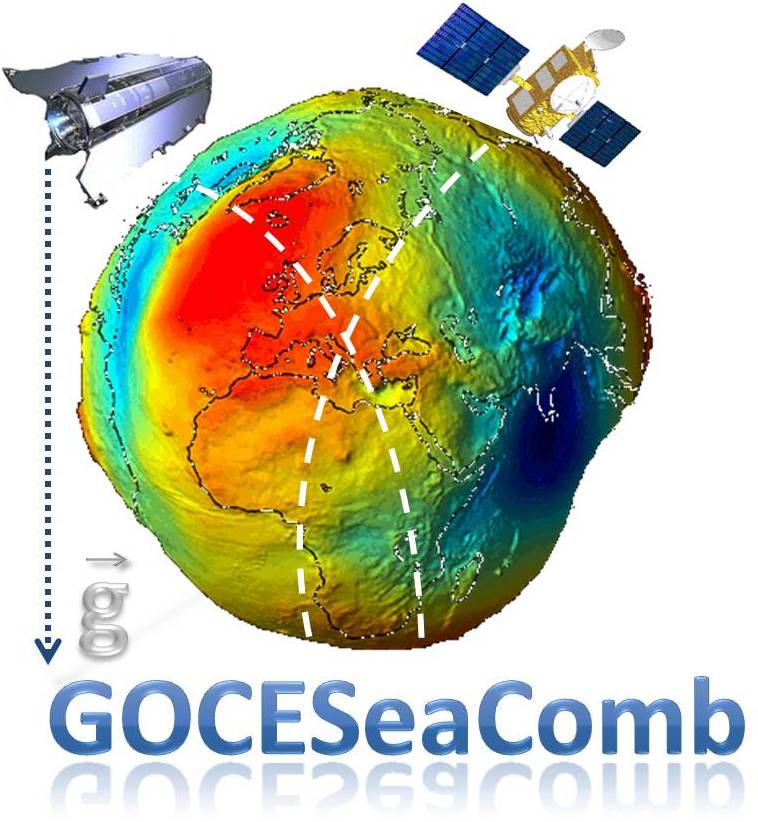
GOCESeaComb at a glance
 Monitoring the Earth’s gravity field both over marine and continental regions has been the focus of extensive geodetic research for the past decades,
but is gaining increasing importance due to the recent gravity-field dedicated satellite missions. With the missions of CHAMP and GRACE setting the path,
the latest ESA mission of GOCE is offering new opportunities for improved insights into the Earth’s gravity field and geoid, while the synergistic use of
geodetic and oceanographic data are promising improved representations of the ocean circulation and the sea level variations mechanisms. Moreover, the
combination of GOCE-type high-quality and accuracy gravity field models with altimetric observations from ESA’s ENVISAT and ERS1/2 missions, offer new
opportunities for the determination of the marine geoid, vertical datum unification and the introduction of a global vertical datum, dynamic ocean topography
(DOT) modelling, etc.
Monitoring the Earth’s gravity field both over marine and continental regions has been the focus of extensive geodetic research for the past decades,
but is gaining increasing importance due to the recent gravity-field dedicated satellite missions. With the missions of CHAMP and GRACE setting the path,
the latest ESA mission of GOCE is offering new opportunities for improved insights into the Earth’s gravity field and geoid, while the synergistic use of
geodetic and oceanographic data are promising improved representations of the ocean circulation and the sea level variations mechanisms. Moreover, the
combination of GOCE-type high-quality and accuracy gravity field models with altimetric observations from ESA’s ENVISAT and ERS1/2 missions, offer new
opportunities for the determination of the marine geoid, vertical datum unification and the introduction of a global vertical datum, dynamic ocean topography
(DOT) modelling, etc.
The key points in such studies, in order to determine rigorously stationary components of the gravity field as the geoid and/or quasi
and non-stationary ones as the DOT, the time-varying DOT and steric and eustatic sea level variations, are: a) The utilization of calibrated and validated
input data, b) the investigation of the spectral content of the input data, and c) the development of data optimal combination methods, considering the
statistical behaviour of the input observations, towards the achievement of high-quality and accuracy predictions.
The aforementioned set the main aim of the GOCESeaComb project, which is related to the exploitation of data from ESA’s GOCE, ENVISAT and ERS1/2 missions towards the modelling and improved understanding of Earth Observations parameters as the geoid, sea level and DOT in the Mediterranean Sea. To reach the main goal of the project, several sub-objectives have been identified, given that the entire study can be broken-down in the following three major steps:
- Study of data prerequisites and methodologies development,
- collection, validation and processing of heterogeneous data and
- optimal combination of the afore mentioned data for gravity field multi-resolution representation, ocean circulation modelling and sea level variations determination.
The first objective is to determine the kind and characteristics of the satellite gravity and altimetry data needed to determine the geoid, sea level and DOT. Satellite altimetry, on one hand, offers an abundance of unprecedented in precision, accuracy and resolution measurements of the instantaneous sea surface of the Earth's oceans. This enables the study of phenomena taking place on the surface of the seas, leading to the better understanding of their physical and environmental properties and processes. The satellite altimetry missions of GEOSAT, ERS1, ERS2, TOPEX/POSEIDON, JASON-1 and ENVISAT offer a long-term time series of observations and allow the determination of the marine gravity field, the monitoring of sea level changes and the observation of the sea level variability. Within the proposed project, this wealth of information and data will be used to determine the instantaneous geometric heights of the sea, sea level anomalies and the ocean circulation.
The second objective is to develop the methodologies to be utilized for the validation of GOCE data and perform the validation. In order to assess and validate the accuracy, spectral content, resolution and noise level of the GOCE gravity-field dedicated satellite mission, Level 2 data will be used. The latter refers firstly to the external calibration/validation of GOCE data against terrestrial gravity data available by the research team both for continental areas (mainland Greece) and marine regions. As far as GOCE data are concerned, the Level 2 data of the satellite will be used in the form of GOCE-only global geopotential models (GGMs). The validation will be performed following two basic methodologies. The first one will use anomaly differences between coefficients from CHAMP-only, GRACE-only and GOCE-only GGMs with the coefficients provided by EGM008 as reference. The same will be performed for anomaly degree variances for the same models, so that the corresponding RMS anomaly differences per degree will be computed. The second methodology will be based on the estimation of the anomaly degree variances from the power spectral density (PSD) of the differences between the GGMs from each satellite and EGM08, as well as the local (terrestrial and marine) gravity data.
The third objective of the project is to develop and apply the methodologies for the optimal combination of GOCE data with altimetric and terrestrial gravity data for geoid, sea level and DOT determination in the Mediterranean Sea, i.e., the utilization of ESA’s data towards Earth observation.