GOCE+++ Project
 With GOCE having completed
its mission at the end of October 2013, there still exists a wide range of applications that GOCE-derived products can have a
significant contribution to. It has been very recently concluded that GOCE, apart from a high-accuracy static gravity field, can offer unique insights to
oceanographic, engineering and geophysical applications. GOCE offers unique scientific opportunities, especially with the latest R5 GGMs which are still
produced and the low-orbit data during the second phase of its mission. In this respect, the GOCE+++ project tackles the use of GOCE observations for the
generation of end-products that will be useful for the wider scientific community and users.
With GOCE having completed
its mission at the end of October 2013, there still exists a wide range of applications that GOCE-derived products can have a
significant contribution to. It has been very recently concluded that GOCE, apart from a high-accuracy static gravity field, can offer unique insights to
oceanographic, engineering and geophysical applications. GOCE offers unique scientific opportunities, especially with the latest R5 GGMs which are still
produced and the low-orbit data during the second phase of its mission. In this respect, the GOCE+++ project tackles the use of GOCE observations for the
generation of end-products that will be useful for the wider scientific community and users.
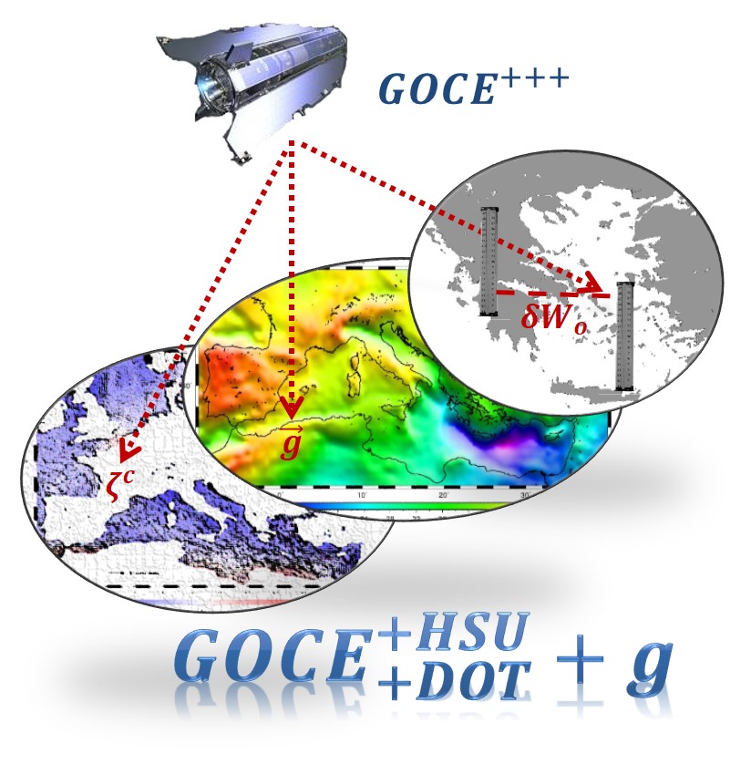
The overall objective of the scientific work to be carried out within GOCESeaComp and the newly launched GOCE+++ is to employ
GOCE data products, mainly the derived GGMs and the original SGG data, in order to: model the geoid regionally in the Mediterranean Sea, determine the Mediterranean DOT,
monitor the SLA and use GOCE data for Height System Unification (HSU). These should be performed after the validation both in a spectral sense and with external gravity-field related data of the GOCE scientific products.
More specifically, the objectives are summarized as follows:
- Validate all available GOCE, GOCE/GRACE and combined GGMs developed during the GOCE mission based on all employed strategies (DIR, TIM, SPW, GOCO, EIGEN, etc.).
- Determine the spectral behavior in terms of signal and error PSD functions of the GOCE GGMs and assess their accuracy with external GPS/Leveling and free-air gravity anomaly data sets.
- Use the GOCE-derived GGMs to model the time-variable DOT in combination with satellite altimetry data.
- Determine empirical and analytical covariance functions for SLA and DOT.
- Model the Earth’s gravity field in terms of geoid model development, with high-accuracy, for the wider Greek territory.
- Model the DOT in the Mediterranean region with the use of GOCE data.
- Determine the systematic offsets of the Greek LVD.
- Estimate, with the use of GOCE data, an optimal zero level geopotential value for mainland of Greece, provide its connection/offset to a WHS and unify the several LVDs of the islands with respect to the mainland using a GOCE geoid.
GOCE+++ is funded by the European Space Agency (ESA) within its Scientific Experiment Development Program (PRODEX) following a successful application to the General Secretariat for Research & Technology (GSRT) after an invitation to the Greek scientific community. GOCE+++ is a continuation of the successfully completed GOCESeaComp Project, launched and funcded in response to the 1st PRODEX Programme Call for Greece.
For more information on GOCE+++, its objectives, workflow, and main findings please browse through the rest of the site. Please note that the Partners Corner is only accessible for registered users, i.e., the project team and ESA PRODEX representatives.
GOCE+++ Latest news
16/02/2016: The GOCE+++ web-page has been launched.
01/02/2016: OCE+++contract signed with the ESA PRODEX Office (Contract No: 4000106380 CN3)
More (News, Conference Presentations and Papers)